Re-Designing Historic Space: Corrective Landscape Planning at Stagville State Historic Site
29 December 2020 – Mary Biggs

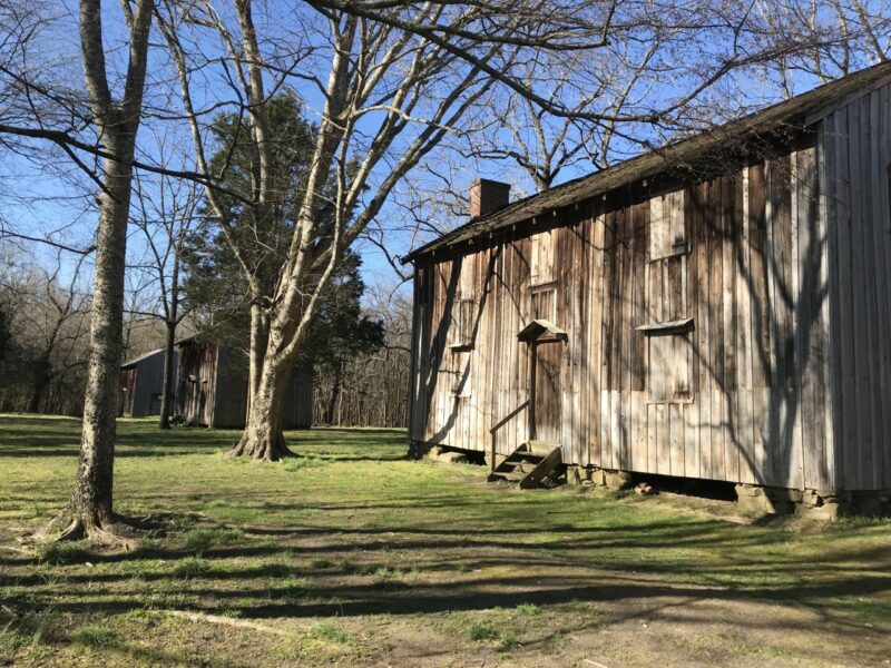
The Horton Grove cabins are some of Stagville’s most compelling features. In one original chimney, visitors can see fingerprints left by enslaved bricklayers. But Horton Grove’s landscape looks very different today than it did in 1860. Photo credit: Mary Biggs
Editors Note: How do historical sites reckon with landscape within interpretive plans? Mary Biggs joins us to explore how one former plantation space in North Carolina uses the landscape on which formally enslaved people worked and lived to reconceptualize visitor experience at that site.
Imagine a historic site. What do you see? Perhaps historic buildings, waysides, a visitor center? Stagville State Historic Site in Durham, North Carolina, has all three, but the site is more than just these structures. Last summer I worked with Vera Cecelski, Stagville’s site manager, to re-imagine Stagville’s current landscape—the outdoor spaces between and around the historic buildings—not as the background to historic buildings but as a key piece of the site itself. The result was a landscape plan that not only enhances visitor experiences but also supports ethical interpretation and care of the site’s resources. At a former plantation site like Stagville, this is not only desirable but imperative for racial justice.
In 1860 Stagville was the largest plantation in North Carolina, encompassing 30,000 acres and worked by nearly 1,000 enslaved people. Today, it is a place where visitors can connect to and reckon with a painful history of racial oppression that still shapes our present. Stagville interpreters focus on Black life and experiences in central North Carolina before and after Emancipation. Along with the eighteenth-century Bennehan House, where the enslaving family lived for multiple generations, Stagville visitors can visit Horton Grove, where five houses built by and for enslaved families in the early 1850s still stand, and the Great Barn, a testament to the enslaved carpenters who completed it in 1860.
However, Stagville’s current layout privileges the white family’s spaces and narratives. The visitor center is next to the Bennehan House, meaning that the site’s only public restrooms, parking, and air-conditioned areas are right next to the white family’s former home. The enslaving family’s house is therefore the most accessible section of the site and each visitor’s first impression on arrival. Further, visitors on guided tours are required to use their cars in order to access both Horton Grove and the Great Barn, resulting in interruptions to the interpretive experience and, again, an inevitable centering of the white family’s domain, especially for those with limited time or mobility. Finally, certain landscape features erase historical truths: the trees that today surround Horton Grove obscure sight lines that once enabled white surveillance of Black communities; mown grass lawns replace the swept dirt yards that Black women maintained around their houses before and after Emancipation; and no surviving agricultural land remains to represent the landscape of forced labor. Stagville’s buildings are invaluable resources for engaging with the site’s Black history, but the landscape itself undermines a full experience of the site’s story.
Stagville is not the only historic plantation to grapple with the tension between maintaining picturesque grounds to attract visitors and telling the painful, vital truth about chattel slavery. A long history of marketing plantation sites as romantic or luxurious tourist destinations often emphasizes an imagined history of opulence and leisure while erasing legacies of forced labor. This is a landscape practice as well as an interpretive one. Many historic plantations today highlight decorative gardens, for example, and center on the Big House while leaving slave dwellings offset from the primary site. Stagville provides a vital contrast to these more well-known images of plantation houses. Instead of spreading vistas that evoke grandeur and nostalgia for a mythic past, Stagville today is cocooned in trees that encourage contemplation of the original buildings and their legacies. Still, the site’s landscape works against equitable interpretation of all parts of the site, despite the best intentions of Cecelski and her staff.
To start this project, we walked the site together on a rainy afternoon in May. Cecelski outlined a long-term vision, including a new visitor center by Horton Grove and pedestrian routes between all three site tracts. I consulted the site’s archival resources to create a historical context for today’s landscape. Our finished plan divides the future vision for the site’s landscape into five main changes and provides interpretive, logistical, and historical reasons for each change. We also created a development plan that breaks down the changes into separate action items ranked by priority, feasibility, and cost. For example, building a new visitor center near Horton Grove will take time and money, but clearing brush for pedestrian paths, which can be done by existing staff, is already underway. In addition, Cecelski plans to re-create a swept dirt yard in front of one of the Horton Grove houses, and the mown grass lawn in front of Horton Grove is slated to be replaced with native Piedmont prairie, evoking the grain fields of the nineteenth century and providing visitors with another perspective on landscape change through time.

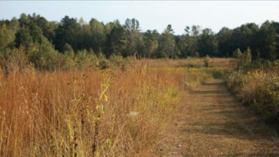
Grasslands used to cover the Piedmont of North Carolina, formed by wildfires, human-made fires, and grazing wildlife. Restoring part of Stagville to Piedmont prairie shows visitors what this landscape looked like long ago while also evoking agricultural land. Photo credit: Emily Oglesby, North Carolina Botanical Garden.
The landscape plan also enables additional interpretation of the site. I created a self-guided tour that allows visitors to learn about the intersections of land and power at Stagville. Instead of physically changing the landscape, the self-guided tour uses the landscape as it looks today to engage visitor imaginations. For example, standing by the Bennehan House—currently framed by mowed green grass and thick stands of pine—the tour describes the working yard of a plantation home: loud, smoky, dusty, busy, tense. The contrast between the site in 1860 and the site today tells its own story of change through time and raises questions about what, and how, we remember.

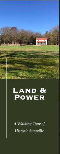
This self-guided tour explores how white and Black communities have understood and changed Stagville’s landscape through time. Image credit: Mary Biggs
In our landscape plan, the land itself is a storyteller. The plan not only addresses important logistical concerns but also works to re-imagine how Stagville can more fully interpret Black enslaved and free experiences in the North Carolina Piedmont. Our plan provides a vision for Stagville that ensures the landscape is managed in accordance with the site’s interpretive goals and enriches visitor experiences in new ways. Instead of attracting visitors by marketing purely aesthetic beauty or purporting to be an authentic recreation of a specific moment in time, we are inspiring visitors to engage with Stagville’s landscape as a complex and ever-changing space of memory, history, and power. Further, the landscape plan ensures that all spaces within the site—Horton Grove, the Great Barn, and the Bennehan House—are valued, developed, and acknowledged with equal meaning and access, reflecting an equitable approach to the interpreted narratives. Modern landscapes can obscure historical realities. By researching a historic site’s landscape over time, and intentionally incorporating the landscape into interpretation and planning, historic sites can enrich visitor experiences and tell the full story at the same time.
~Mary Biggs is a Ph.D. student in the Department of Geography at the University of North Carolina at Chapel Hill. She researches the intersection of natural and cultural resource management through the landscapes of public historic sites, especially those associated with slavery in the U.S. South.


